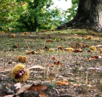
Surely the best way to get to know  the "God’s little valley" is to walk, without haste, along the numerous paths and roads that cross it, entering the woods. The woods of Caprese are not wild forests. For centuries they have been frequented and lived by the local population, who have left the signs of this anthropization: ancient cobbled streets, chestnut dryers, shelters for woodcutters, churches and shrines. Equipped with a map of the trails you can make numerous excursions, on foot or by mountain bike, or even simple walks, through the woods. Despite its variety of scenarios, in fact, the territory of Caprese is not very large (66 sq km ) and, therefore, almost all the itineraries can be covered in half a day or even a few hours. The paths or the ancient roads that go into the forest, then, start directly from the main hamlets such as Manzi, Caroni, San Polo, Ponte Singerna, Lama, Fragaiolo and Samprocino.

Servizi disponibili:

Centri visita Foto Bike Percorsi

The map:

Alpe della Faggeta -Prati della Regina and Eremo della Casella

trekking


It is the longest route of all even if, for the stretch from Prati to Casella, there are no significant differences in height since the entire route develops along the ridge of the mountain range, among the beech woods, with breathtaking views towards the Valtiberina on the one side, and the Casentino valley on the other.


If you want you can stop at the Prati della Regina: they are a long and restful grassy strip that runs along the entire top of the Alpe della Faggeta. The highest point is called Monte Castello, perhaps because, despite the height (1415 meters) there was indeed an ancient fortification (if not a real fortified village). Not far away are the imposing cliff of the Sasso della Regina and the monument to the victims of the Second World War. On the top of these beautiful meadows there was a bloody battle place, and its traces of the trenches still remain standing.
 

Covered Cross and the Balza di San Francesco

trekking


Covered Cross and the Balza di San Francesco


This itinerary is challenging but can be done in three to four hours. It develops on the crest of the wooded hill that runs along the Singerna to the east, from Gregnano to Frasca Verde. The top of the long hill is called the Covered Cross because it is believed that a hermitage would have arisen in the middle of the forest. The road starts from Gregnano and winds up to the rather flat top of the hill. From here another road, between meadows and woods, leads towards east and, passing through Armena, reaches the wide and beautiful plain of San Casciano, along the road to Pieve Santo Stefano. Continuing along the crest of the hill, not without difficulty, you will reach the Balza di San Francesco. Here the saint, on one of his trips to La Verna, sat down to rest and the stone actually has the imprint of a seated man. There is no chapel and not even a cross: around the footprint there is only the solitude of the wood. The path, going downwards ends near the ancient abbey of Tifi, dating back to the Middle Ages, which dominates the landscape surrounded by olive trees.

The via delle Celle

trekking

 The via delle Celle


This route, along a gravel road that can also be traveled by car therefore also excellent for bicycles, starts from the road between Fragaiolo and Valboncione and leads to Monte Faggeto (this is the name by which Caprese indicates the Alpe di Catenaia) at over 1000 meters above sea level. The first thing you notice, lonely on the top of a hill on the right, are the ruins of the church of Centosoldi or Censoldo, completely covered with vegetation. This is the ancient church of Fragaiolo, which dates back to the Middle Ages.
It was dedicated to San Biagio but the exact origin of its strange name is not known. It has been assumed that it derives from "Centosoli" due to its magnificent and continuous exposure to the sun. Paying attention to the rubble you can climb to the top in front of the church and enjoy some beautiful views over the Caprese valley, the Alpe della Luna , the Alpe della Faggeta and, perched on the slopes of the hill itself, on the characteristic village of Valboncione. The remains of a large bonfire can still be seen. In reality there was more than one bonfire: every year, for centuries, on the night of February 3, the day of San Biagio, the population of Fragaiolo went up this hill to light the great “ San Biagio bonfire”. The tradition still survives but the bonfire is now lit in the town.
On your way back to the road, you will cross centuries-old chestnut groves with enormous chestnut trees and you will soon reach the Camaiano stream, with its crystal clear waters. The source is very close. A wooden bridge crosses the road.
The road begins to climb and you will come across  an ancient and very large chestnut drying room. Although the valley is very narrow , the landscape opens up more and more as you go up. The centuries-old chestnut trees begin to give way to the beech trees and  this is the point where we arrive at the Celle. First you will spot one house and, later on, on a magnificent plateau with very large chestnut trees, another one. These two houses, private and still used for holidays, are of very ancient origin, probably a few centuries old: their position at that height and in the middle of the forest, very far from inhabited centers, is very particular . In front of the second house, lower down, a giant of nature: a huge and centuries-old chestnut tree, one of the largest in the Apennines.
 

The Via dell'Aiola

trekking

The Via dell'Aiola


It is a short and very easy route (scarce three hours) which, crossing the chestnut groves, leads from the Lama to Trecciano, along the road to Alpe della Faggeta. The beginning, from Lama's side, is in the Bozie group of houses. From here you descend towards the Camaiano stream at the point where the Fosso Buio flows into it: it is a very shady place, cool even in the height of summer.
Beyond the stream there is an ancient mill. Following the road, the altitude increases and the oaks are replaced by chestnut woods. Due to many factors, including climate change, the altitude at which chestnuts grow is increasing more and more: it is said that once they reached the Lama (500 meters). Along the way you will encounter numerous and very clear streams that descend towards the Camaiano, while the panorama opens up more and more: the characteristic village of Valbancio stands out, perched on a hill in front of it, with its ancient stone houses arranged in a cascade; immediately above, on the crest of the hill, the evocative and solitary ruins of the church of Censoldo, in the middle of the woods.
Among the chestnut groves there are numerous ancient drying rooms in which once the chestnuts were dried in order to obtain flour from them. They date back to the Middle Ages and, those that are not in ruins, are used during the chestnut process as a shelter or as a tool shed. The route ends near Trecciano along the asphalted road that leads to Alpe della Faggeta, right at the base of the hill, on which the ancient castle of Trecciano once stood. 


The Way of the Terre Gialle

trekking

The Way of the Terre Gialle


It is a rather comfortable route which develops on a gravel road in the middle of the woods which takes three hours to walk.  It connects Trecciano with the sanctuary of the Selva. Easy paths, still unpaved, connect the road to the various localities in almost regular intervals: Colle di San Polo, San Polo, Caroni (through Gorfi) and Manzi.
The itinerary starts from Trecciano, essentially located along the road that connects Caprese with the Alpe della Faggetta. However, the ancient castle of Trecciano did not rise in the present place but in a dominant position on the high hill behind the village, along the watershed with the deep valley of the Lama.
The landscape is very open: the view extends from Romagna with Monte Fumaiolo to Lake Montedoglio. Opposite, apart from Singerna, there is a first line of hills:  the hill of the lost abbey of Dicciano, Poggio Rosso and Fungaia. In addition to these, separated from the Tiber valley, the imposing bulk of the Alpe della Luna.
Trecciano is located at the point where the cultivated areas and pastures end and the great forest of the Alpe della Faggeta begins. Shortly after, after passing the group of houses in Cà del Lucchio, you go into the woods. After crossing the clear waters of the Cerfone torrent at Colle di San Polo you reach the splendid chestnut groves of the “Terre Gialle”. The name of the place is given by the particular color of the ground, an intense ocher, sometimes reddish, where the centuries-old chestnut trees thrive.
Continuing in the woods notice the presence of a centuries-old anthropization and look below is the large, perfectly flat lawn on which the castle of Priello once stood. It was a real village, named Perillo, with houses and its church, dedicated first to San Pietro and then to Santa Lucia. According to ancient documents, San Francesco, on one of his trips to La Verna, helped restore this church, as he did shortly after with that of San Polo. Nothing remains of the ancient past: there is only the vast grassy lawn with a splendid view that goes from Verna to the willagr of Caroni, below, and to the Alpe della Luna, on the opposite side.
Next, you reach the characteristic stone hamlet of Selva Perugina, whose dialect name has changed to become Samprocino. It is located on the edge of the chestnut groves, on one side, and the fields and meadows, on the other. Close to the hamlet, in the middle of a magnificent chestnut wood, you arrive at the sanctuary of the Selva, solitary in the silence of the forest.

The routes to the Eremo della Casella

trekking

The routes to the Eremo della Casella


The hermitage, with its church, stands on the top of Monte Foresto, about 1300 meters high and can be reached by two alternative roads in just over an hour's walk: one goes up from the village of Fragaiolo, the other from the area of Sovaggio (Muggibiano).
The first, although steeper, and in any case unpaved, can also be traveled by car; about 500 meters before the sanctuary, however, you have to leave them out of respect for the place.
From the height of Fragaiolo, the road enters the splendid chestnut groves that shade the path. Among these, scattered in the woods, there are ancient stone buildings walled up with the earth: they are the drying rooms for chestnuts, which date back to the Middle Ages. Some are abandoned and in ruins, others are still used, during the chestnut harvest process, as a shelter or as tool sheds. Once, for about a month, chestnuts were dried there: a fire that made a lot of smoke was to be kept constantly burning, but without the flames. Climbing more and more, the chestnuts give way to the dense beech trees, which they accompany up to the top where  a vast meadow stretches around the small and solitary sanctuary.
The way up from Sovaggio, although more bumpy, is much less steep. It does not go into the dense wood like that of Fragaiolo but opens up to wide panoramas, both towards the Valtiberina and towards the Casentino. In its first part the landscape is that of the moor: large boulders, grass and shrubs. As you go up the path is marked by large wooden crosses that recall its sacredness linked to San Francesco: the cross of the Varco, the cross of the Malcima and, in the large meadow on the top, the cross of the Casella.
 

Poggio Rosso and the "Acqua Puzza"

trekking

Poggio Rosso and the "Acqua Puzza"


Poggio Rosso is located on the left side of the Singerna, next to the Fungaia hill. It has a particular landscape, much less luxuriant than the rest of the Caprese area, which at times appears almost "lunar", with rocks that emerge on the surface and the sparse and scattered vegetation. Certainly there is no human presence: it is a state nature reserve and many of the trees that are there (especially Arizona cypresses) have been planted by the Forestry within a reforestation program.
Poggio Rosso can be reached from the north, from the San Casciano area (in this case with a comfortable gravel road) or from the south, via a CAI path. Starting from the town of Gamboli, near Manzi, the path retraces an ancient Roman road whose  pavement can still be seen: it is the Via Ariminiensis (via Riminese) which connected, from west to east, Arezzo with Rimini. It passed from Poggio Rosso and crossed the Apennines through the Via Maior pass (Via Maggiore, the current Viamaggio), and then continued along the course of the Marecchia. Once you arrive near the locality of Ontaneto, cross the Singerna, immediately after meeting the ruins of the ancient Mulino di Fungaia, abandoned for decades. It is the last building you come across. Poggio Rosso, as well as for the particular and unusual natural landscape, offers a splendid panorama towards the right bank of the Singerna, from the Monti Rognosi  to Caprese, all dominated by the wooded mountain of the Alpe della Faggeta. But the place also has another peculiarity: the so-called “Acqua Puzza”, smelly water. As the matter of fact,  From the subsoil gases come out among which, the sulfur (which gives the sensation of bad smell). In the three cavities from which the gases come out, however, rainwater stagnates which, therefore, continuously boils, despite being at room temperature. There are therefore, within the reserve, three springs of “Acqua Puzza”. Once the mud from these springs was used to treat rheumatism. If the weather was particularly dry and therefore the springs were dry , it was enough to bring water with you: as soon as it was thrown where the gas comes out, it began to boil and therefore formed new mud to be applied.

Path of "Frasca Verde"

trekking

Path of "Frasca Verde"


It is a short journey, lasting about an hour, and quite easy. The Frasca Verde is the narrow gorge that delimits the hill of the Caprese castle to the north, through which the Singerna leaves the Lama basin. It is a very narrow gorge which, on its left side, has a large rock; here, it is said that, hidden somewhere, there is a fairy cave "la Buca delle Fate".
It seems that a speleologist at the beginning of the twentieth century had found the entrance but, to avoid accidents, it was closed forever.
The road follows the layout of an ancient abandoned Roman road, of which in many points you can see the regular pavement and, on the opposite side to that of Caprese, it connects the medieval abbey of Tifi with Lama hamlet.  A peculiarity of the area crossed by this road is that, being exposed to the south, in full sun, and protected from the north wind, it is never subject to cold temperatures, even in the middle of winter. In its first part, starting from Tifi, you go through olive groves and then reach a superb and unusual view of the castle of Caprese, very close to but separated by the Frasca Verde.
Going back down towards the Lama, the landscape changes considerably: there are no longer any signs of human activity and the forest has regained possession of the once cultivated land : among the vegetation you can still see the remains of the dry stone walls of the ancient terraces.
The route passes over the gorge, halfway up the slope, without ever reaching it. However, you can get to Frasca Verde, with its San Giovanni wood, with a very simple walk of less than five minutes: just take the gravel road downhill at the "Lama" sign that you find coming down from the Caprese hill. In the summer it is a great place to swim in the Singerna.